
|
The
Use of MacRoad in the Design of an Urban Highway in the U.K.
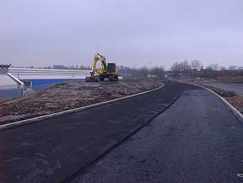
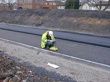
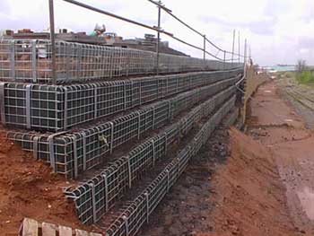
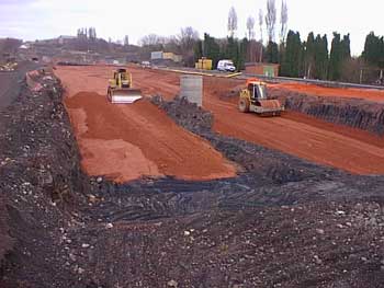
Professor Peter Rankilor was the earthworks and environmental consultant for the design of a 4 km urban bypass in the United Kingdom (project completed December 1999). This dual lane, dual carriageway highway passed through heavily built-up areas in one of the United Kingdom's oldest industrialised areas. A new twin-track railway line was also to be constructed at the side of the bypass, over the most difficult part of the route.
Although he was using what is now a relatively old laptop, Professor Rankilor found that the entire data set went into his machine easily. After unifying the four separate sets of MOSS data, one of the first things he noticed was that one of the sets was in error. Due to the illness of one of the CAD operators, one data set was inadvertently outdated. The border edge errors became obvious when placed on a single MacRoad layout. This was corrected, saving potential disputes with the contractor during the construction stage. Using MacRoad, Professor Rankilor was able to handle the full data set that had previously necessitated four CAD operators. He could continuously design the earthwork profile along the whole of the bypass and insert cross sections into his slip circle analysis programs to design the stability of the embankments and cuttings. The cross section feature with its detailed co-ordinates output made the transfer of data into slip circle analysis and structural programs easy.
Within a short space of time, Professor Rankilor was able to add a wider carriageway onto the old design and calculate new cross sections, volumes and undertake the total stability redesign. Without MacRoad, he would have been forced to rely upon the slow production of cross sections from the MOSS system. What would have taken many weeks was done in just a couple of days. MacRoad produced the schematics of the revised requirements, the volumetric calculations for preliminary financial discussions with the contractor, cross sections and plans for the guidance of the MOSS team, borehole position maps for the necessitated new site investigation and land boundary plans for negotiations with the railway company. Without MacRoad all this would have been impossible to achieve as quickly as necessary. Professor Rankilor emphasises that the heavyweight packages such as MOSS do have many features that MacRoad does not have such as the ability to produce cross sections at any angle across the DTM (albeit very slowly). Also, the large programs such as MOSS are capable of a very high level of detail which is often required for modern works. Moss can create any complex type of multiple interchange and detailed features. However, he also states that these larger programs are made for a different purpose from MacRoad. They are more 'construction detailing' software rather than true 'design' programs. MacRoad allows the engineer to hold the whole project in laptop memory, to go on site with it and use it to really design things. Therefore, Professor Rankilor sees MacRoad and MOSS-type packages working together. He suggests that the engineer uses MacRoad to work in conjunction with MOSS, thus creating the perfect team situation.
The ability to superimpose the sloping banks onto the contour map of the original ground surfaces allowed Professor Rankilor to calculate and determine the edge drainage requirements for the embankments. Without MacRoad they would have been very difficult to manually assess. MacRoad really proved its worth time and time again in other cases and in producing handy maps and sections for the many public interface enquiries that the Authorities responded to during the course of the works. As far as the standard design of the highway was concerned, the earthworks for this major £20,000,000 scheme were entirely designed using MacRoad. The MOSS and CAD systems used by the client became a historical recorder of what MacRoad designed. Beyond the standard design benefits of MacRoad, Professor Rankilor, being also a Geologist and Mining Consultant, used MacRoad's contouring facilities to interpret the subsurface geological features of the site. [Editor's note: Professor Rankilor's innovative use of MacRoad for geotechnical purposes will be the subject of a followup article. This will include details of borehole analysis, creating contours of rockhead, plotting strata such as mine workings, creation of isopachyte (thickness contours) plans. This will be published here soon.]
Professor Rankilor has asked us to say that MacRoad was not only useful, but - without any exaggeration - it was incredibly useful. For him it was indispensable. As well as for highway design, Professor Rankilor advocates MacRoad for many earthworks and project assessment purposes where quick realistic overviews of potential projects can win the day in bidding or selling ideas to clients. Professor Rankilor says that he is looking forward to using the new HighRoad program and feels that many more of his clients will benefit from it now it is available for PC.
|
News
and Events | Products | Ordering
Info | Downloads | Support
Projects | Contacts
| Links | Company |
Site Map | Feedback
© Creative
Engineering Australia 2001. Disclaimer
Last Updated: 30 May 2001


